Family Friendly Fall Hikes in Truckee-Tahoe
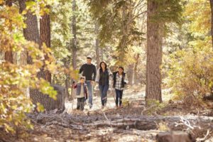 Clear skies, cool nights, warm and wonderfully colorful fall days are here! With all there is to do with your family in the great outdoors during the fall season, we encourage you to take some downtime and get up and get outside now!
Below you will find just the beginning of a list of easy hikes to enjoy during this beautiful time of the year. For more ideas, never hesitate to contact us at Elder Group Tahoe ǀ Engel & Völkers. We love sharing the many assets that come with mountain homeownership in Truckee-Tahoe.
Before you head out on the trail, take a moment to download these free Nature Scavenger Hunts for your kids. Grown-ups like them too!
Truckee Area

Whether you head north, east, south, or west, you will be sure to find a variety of trails for all ability levels throughout the Donner Summit region. An online article perhaps says it best:
“Trails leading out north or south from the top of the pass have spectacular views down the slopes to east and west. In the off-the-beaten-path Grouse Ridge area, a network of moderate trails winds among lakes. More hikes are found off Highway 20 and Interstate 80, some easy walks, others steep climbs.”
When you click into this informative website page about hikes throughout Donner Summit you can review all the specifics and perhaps plan a full week enjoying the great outdoors, fresh air, and beautiful fall scenery as well.
A leisurely stroll around Donner Lake near Truckee is great for children and the elderly, and features amazing views of the lake, the Rainbow Bridge and the mountains. The trail follows a counterclockwise way around the lake and takes you into the surrounding pine forest. For the more adventurous, click into this article that further explains how you can extend your hike into the Pacific Crest Trail and other high-mountain hiking, biking, and equestrian trails. This is an excellent educational hike as well. At the trail head, you can learn all about the historic Donner Party and their ill-fated trip over the Sierra. To get to the start of this scenic loop, take Donner Pass Road to Donner Lake. Right there, you will see the Donner Lake Memorial that is on the east side of the lake.
Here is another super spot for kids, and for a lunch break if you happen to be working near the Truckee Airport! To get to this extremely popular trailhead, from Donner Pass Road, head east on Brockway Road, turn right on SR 267, and just after the airport you will see a Wildlife Viewing Area sign. It is highly likely you will see some other cars parked along the road. It is a beautiful, flat, 4.3-mile trail that will take you through a vista-filled meadow and running river. Birdwatching is popular here, and during the early fall season, you will probably still see some indigenous wildflowers along the way.
Olympic Valley
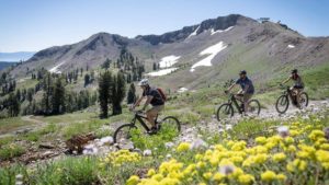 No matter where your travels may lead, the views from bottom to top and back again will be set in your mind and memories for years to come.
Within the Squaw/Alpine website there is a perfect list to get your plans underway for a beautiful trek in the High Sierra. Look at the content below that is courtesy of the resort’s website, then pack your picnic and head to the hills!
Trollstigen Trail
This gentle trail traverses the base of Olympic Valley from the Resort at Squaw Creek to the Village at Squaw Valley. It is a nice .06-mile stroll that meanders in and out of the trees just above the valley floor. At this point, you can enjoy spectacular views of the meadow and surrounding peaks.
World Cup Trail
For a quick hike or the start to a lifetime adventure, enjoy the short .07-mile path or use this trail to access the national historic and scenic designated Western States Trail, which stretches from Salt Lake City, Utah, to Sacramento, California.
Shirley Canyon Trail
This is one of Lake Tahoe’s best half-day 3.6-mile hikes. Hike alongside waterfalls and granite boulders and take in breathtaking views of Squaw Valley. To access the trailhead, go to the end of Squaw Peak Road and park on the side of the road. This trail can be difficult to follow, so remember the general rule is to keep the creek on your right and follow it up for about 2.5 miles until you come to giant granite rock slabs and continue up to Shirley Lake.
Thunder Mountain Trail
The Thunder Mountain Trail is the perfect 3.2-mile hike to explore Squaw Valley from the base to High Camp. Hikers start their adventure at the bottom of the Exhibition chairlift or from the bottom of the summer construction access road at the bottom of the KT-22 chairlift. From here follow the signs that lead you up the South fork of Squaw Creek toward the top of the Ariel Tram and High Camp. Continue on the trail winding up the mountain. Your destination will be just below the Ice Rink facility at High Camp.
Lake Tahoe – West Shore
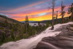
Eagle Falls
We love this hike located just above the magical Emerald Bay on the west shore of Lake Tahoe. During this time of the year, the colors are just turning, and the creeks and waterfalls are still running with their crystal-clear waters. It is also a short and easy hike with a well-maintained and marked trail. From the north shore, head south on Highway 89 until you see Emerald Bay. There is a parking area on the east side of the road; the trail starts just across the street. Include some time to capture a photo of the Bay … “one of the most photographed sights in the world” according to the professionals at Kodak.
Taylor Creek Loop
While you are down on that end of the lake, make a day of it and continue to head south to Taylor Creek. Although the Visitors Center is not open at this time, the trail welcomes those who seek an easy stroll on a one-mile loop through a flat meadow wrapped with flickering Aspens filled with the golden hues of the season. This is a real nice spot for a picnic as well. Depending on the day, you may see some of our ‘local’ Bald Eagles that frequent the area during this time of the year when the Kokanee Salmon return to their home to spawn along Taylor Creek.
Lake Tahoe – East Shore
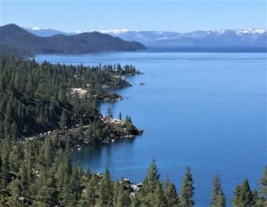 Tunnel Creek Trail & Monkey Rock
There is a great reward for you and yours when you hike up to see this iconic rock that sits atop an outstanding view of the entire lake. To get there, go to the east side of Incline Village on Hwy 28 where you will see a parking area. From there, it is all uphill and along one of the most scenic trails in Lake Tahoe. There is a spot about a mile up that we affectionally call “Christmas Card Corner.” The photo above was taken from that spot that can be the ideal background for your next family photo! Dog lovers, trail runners and mountain bikers love this trail, so keep your eyes and ears open for their arrival and quick departures.
Chickadee Ridge
This two-mile trail is located off the Mount Rose Highway in a section that the locals call “Sheep Flats” where there is ample parking and access to this trail and many other options on which to enjoy. According to AllTrails.com, the course is rated as “moderate” yet we have seen families with young children accomplish this short, scenic trail with no problem at all.
ADA Friendly – Tahoe Meadows, Mt. Rose Highway
Called the Tahoe Meadows Whole Access Trail, this 1-mile loop through meadows and forested glades is suitable for wheelchairs and strollers. The entire trail has three bridges crossing over picturesque streams, and wildflowers are often abundant. From the junction of highways SR 28 and SR 431 in Incline Village, NV, drive east on 431 (the Mt. Rose Highway) 7.7 miles to the right-side parking lot. The trail starts immediately in the lower lot.
Happy Trails
 As you continue to enjoy our beautiful back yard, please remember to adhere to our socially distant practices and wear your mask to keep everyone safe and healthy.
Contact Alison and Your Friends at Elder Group Tahoe
Like Us on Facebook to Stay Connected
Enjoy Elder Group’s YouTube Channel!

Leave a Reply